Bangalore’s Pink Line Metro: Inauguration, Traffic Impact and What Commuters Need to Know
KM Afaq ·
Bangalore’s Pink Line Metro: Inauguration, Traffic Impact and What Commuters Need to Know — The Pink Line’s 7.5 km opening adds a new interchange and over 100 km to Bangalore’s metro, but may increase RV Road congestion. Find out the impact and commuter tips.
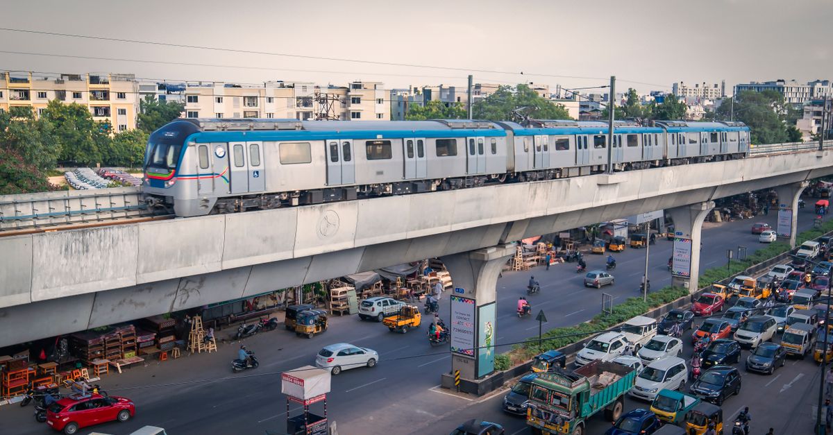
About Bangalore’s Pink Line Metro: Inauguration, Traffic Impact and What Commuters Need to Know
Introduction
Bengaluru’s Namma Metro is about to gain a fresh artery – the Pink Line. A 7.5 km elevated segment from Kalena Agrahara to Tavarekere is slated for inauguration by Prime Minister Narendra Modi on 13 November (as reported by The Hindu and Economic Times). The stretch will host six stations, create a third metro interchange at Jayadeva Hospital, and push the operational network past the 100 km mark. While the new line promises faster cross‑city trips, local residents and daily commuters have voiced concerns that a partial opening could aggravate traffic at the RV Road interchange. This article analyses the factual background, expected benefits, possible bottlenecks, and practical steps for commuters.
1. Background and Current Status
- Line length: 7.5 km (elevated) – part of a 21.25 km Pink Line that will eventually run from Kalena Agrahara to Nagawara.
- Stations on the first stretch: Kalena Agrahara, Hulimavu, IIM‑B, JP Nagar 4th Phase, Jayadeva Hospital, Tavarekere.
- Safety clearance: The Commissioner of Metro Railway Safety (CMRS) completed a three‑day statutory inspection (6‑8 Oct 2026) and raised 36 observations on 9 Oct 2026. BMRCL must address these before passenger services can start.
- Network impact: Adding the stretch lifts Namma Metro’s total operational length to ≈ 103.6 km, making it the second‑longest metro system in India.
- Ridership projection: Once fully operational, the network is expected to serve over 1 million daily riders.
The inauguration date announced by the Prime Minister aligns with the government’s push to showcase infrastructure progress before the year‑end. However, the final go‑ahead still hinges on BMRCL’s compliance with CMRS observations.
2. Route Overview and Key Interchanges
| Station | Location | Notable Nearby Landmarks |
|---|---|---|
| Kalena Agrahara | Bannerghatta Road (south) | Residential clusters, tech parks |
| Hulimavu | Bannerghatta Road | Emerging mixed‑use zone |
| IIM‑B | Bannerghatta Road | Indian Institute of Management Bangalore |
| JP Nagar 4th Phase | JP Nagar | Residential colonies, shopping hubs |
| Jayadeva Hospital | Bannerghatta Road | Interchange with Yellow Line (Phase 2) |
| Tavarekere | Bannerghatta Road (north) | Commercial offices, bus depot |
The Jayadeva Hospital station will be Bengaluru’s third metro interchange, linking the Pink Line with the existing Yellow Line. This connectivity is expected to reduce travel time between the southern tech corridor and the city centre.
3. Anticipated Benefits
- Travel time savings: Trips that currently require 30‑40 minutes by road (e.g., Kalena Agrahara → JP Nagar) could drop to 12‑15 minutes on the metro.
- De‑congestion of arterial roads: By diverting a share of private‑car and bus traffic to the elevated line, Bannerghatta Road may see smoother flow, especially during peak hours.
- Environmental gains: Each metro‑rider offsets roughly 0.5 kg of CO₂ per trip, contributing to Bengaluru’s climate targets.
- Economic uplift: Improved accessibility often spurs commercial activity around stations, raising property values and encouraging retail investment.
- Network resilience: The new interchange offers alternative routing for passengers when other lines experience disruptions.
4. Commuter Concerns: RV Road Congestion
A The Hindu article dated 12 Oct 2023 highlighted a specific worry: partial opening may increase congestion at the RV Road interchange. The reasoning is straightforward:
- Limited service area: Only the southern elevated stretch will be operational, leaving the northern underground segment closed. Commuters from the north will still rely on road transport to reach the nearest metro entry point.
- Feeder‑bus bottleneck: Existing bus routes that feed the new stations may become overcrowded, leading to longer dwell times at bus stops.
- Parking spill‑over: Early‑morning commuters might park near the stations and walk, creating pedestrian‑vehicle conflicts on RV Road.
If not managed, these factors could temporarily worsen traffic flow at the already busy RV Road‑Mysore Road junction.
5. Traffic Modelling Insights
Urban planners use simulation tools to forecast the impact of new transit corridors. While exact figures for the Pink Line are still under review, comparable Indian metros show:
- 10‑15 % reduction in peak‑hour vehicle kilometres travelled (VKT) within a 2‑km radius of new stations.
- 5‑7 % increase in traffic density at nearby junctions during the first three months, mainly due to mode‑shift lag and driver unfamiliarity.
- Gradual stabilisation after 6‑12 months as commuters adjust routes and feeder services are optimised.
Applying these trends suggests that RV Road may experience a short‑term uptick in traffic, followed by a steady decline as the metro gains ridership.
6. Risks and Limitations
- Safety‑clearance delays: The 36 CMRS observations must be cleared; any postponement pushes the inauguration further.
- Incomplete feeder network: Without coordinated bus, auto‑rickshaw, and non‑motorised options, the metro’s catch‑area remains limited.
- First‑day crowding: A high‑profile inauguration often draws large crowds, testing station crowd‑management protocols.
- Parking pressure: Lack of dedicated park‑and‑ride facilities may force commuters to use on‑street parking, aggravating congestion.
7. Actionable Tips for Commuters
- Plan alternative routes for the first two weeks after launch, especially if you travel through RV Road during peak hours.
- Use real‑time apps (e.g., Google Maps, Namma Metro’s official app) to check train frequencies and bus‑to‑metro connections.
- Consider staggered travel times if your schedule permits; early‑morning or late‑evening trips may be less crowded.
- Leverage the Jayadeva Hospital interchange to bypass congested surface roads when moving between the south and central business districts.
- Stay informed about any CMRS‑related delays; official BMRCL bulletins will announce the final opening date.
8. Future Outlook
The Pink Line’s full 21.25 km alignment will eventually include a 13.76 km underground segment from Dairy Circle to Nagawara, linking key hubs like MG Road and Pottery Town. Once complete, the line will provide a direct north‑south spine, reducing reliance on the over‑burdened Outer Ring Road corridor.
Long‑term benefits could include:
- Daily ridership crossing the 10‑lakh mark, as projected by Indian Express.
- Integration with upcoming Orange Line (Phase 3) to create a true grid network.
- Potential for transit‑oriented development (TOD) around stations, fostering mixed‑use neighborhoods that cut the need for long car trips.
Conclusion
The inauguration of Bengaluru’s 7.5 km Pink Line stretch marks a pivotal step toward a more connected, less car‑dependent city. While the immediate effect may be a temporary rise in traffic at the RV Road interchange, the broader picture points to significant travel‑time savings, environmental benefits, and economic uplift. Success will depend on timely safety clearances, robust feeder services, and proactive commuter adaptation. By staying informed and planning ahead, Bangalore’s residents can turn the Pink Line into a daily advantage rather than a source of frustration.
Original source or publisher — consult this source for current information.